Last Updated on July 30, 2025 7:28 am by BIZNAMA NEWS
AMN
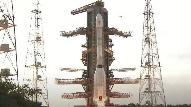
In a landmark step towards strengthening global climate observation and disaster response, India on Wednesday successfully launched a cutting-edge radar imaging satellite developed jointly with NASA. The satellite, named NISAR (NASA-ISRO Synthetic Aperture Radar), is a first-of-its-kind collaboration between the Indian Space Research Organisation (ISRO) and the U.S. space agency NASA.
The high-profile satellite mission, valued at $1.5 billion, lifted off from the Satish Dhawan Space Centre in Sriharikota at 5:40 PM IST (12:10 GMT) aboard a medium-lift rocket. This marks a major milestone not only in Indo-U.S. space cooperation but also in the evolution of Earth observation technologies.
What sets NISAR apart globally is its unprecedented dual-frequency radar system. It is the world’s first radar imaging satellite equipped to operate with both L-band radar (provided by NASA) and S-band radar (developed by ISRO). This dual-band capability allows NISAR to detect minute changes in Earth’s surface — as small as one centimetre — offering powerful insights into natural processes like earthquakes, landslides, glaciers, and shifting tectonic plates.
The satellite is expected to be a game-changer for climate change research, providing high-resolution, continuous monitoring of Earth’s land and ice surfaces. It will also assist in assessing natural disaster impacts, monitoring agricultural changes, tracking forest cover, and studying wetland ecosystems.
With this launch, India has reinforced its growing reputation for cost-effective yet technologically advanced space missions, while also signalling its rising leadership in global Earth science initiatives. For NASA, the collaboration builds on its commitment to strengthening international partnerships in space exploration and Earth monitoring.
NISAR is expected to begin its scientific operations soon and contribute critical data for researchers and policymakers across the globe, especially in a world increasingly challenged by the effects of a changing climate.